Many times we have canoed Slocan Lake and enjoyed the valley’s scenery from the water perspective. In July 2008 we start in a group of four to paddle the whole lake from its northern to its southern end.
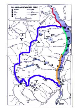
Our trip begins in Hills and finishes in Slocan where the lake ends and Slocan River begins. It takes us along the lake’s west bank which is almost uninhabited and mostly belongs to Valhalla Provincial Park.
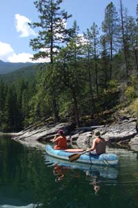
Smooth Rocks at the Bank
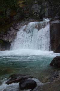
Nemo Creek Waterfall
The first evening proofs again how fast the weather can change at Slocan Lake and reminds us never to underestimate the lake. Winds start blowing, the sky darkens and within only half an hour waves have reached an impressive height. We witness as a canoe turns over in the middle of the lake. Luckily a man in new Denver watches the accident through his binoculars and alarms fast helpers. They rescue the canoeists who not even wore life jackets. Easily this adventure could have ended tragic.
After a rainy night the next day again is bright and clear. No cloud at the sky, no wind, we can hear the singing birds in the trees. We take our time, glide slowly along the shore and enjoy nature around us. From the water the landscape gets a new face. High rising Idaho Peak at the eastern lake side and Silverton and New Denver disappear in the back.
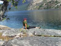
Break in the Sun
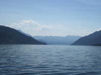
Remote Slocan Lake
The third day again is a stunning summer day. With many breaks to take a bath we paddle the last stretch to Slocan. We pass the First Nations pictographs on the rock walls which remind us that there have been people here some 3000 years before us. After finishing the trip in Slocan, we all agree: The next time we will take at least double the time for the tour.
Elisabeth von Ah
Our Daily Stretches :
1.Day: Hills - Wee Sandy Beach
2.Day: Wee Sandy Beach - Cove Creek
3.Day: Cove Creek - Slocan
|
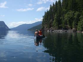
All Slocan lake in front of us
Slocan Lake is about 40km long, at its widest part near New Denver and Silverton almost 2km wide and over 300m deep. Shaped like a long stretched fjord Slocan Lake is embedded by the high ranges of the Valhalla Mountains to the west and the Selkirk Mountains to the east. Dense rainforests cover the west shore slopes from valley bottom to the timberline.
The landscape along the west bank changes between smooth round rocks covered with moss, sandy beaches, impermeable forest and the estuarities of the creeks. High in the alpine region springs feed numerous creeks, which caved their way down in millions of years. The water created deep canyons and gorges with impressive waterfalls and flows year round. Lake fish like the cold clear fresh creek water and fishermen know that the creek mouths are a good spot to fish.
The first day brings warm summer weather and we stop many times for a refreshing swim. Our first camp is at Wee Sandy Beach. The Valhalla shore of the lake offers many wonderfully located wilderness campgrounds with picnic tables, outhouses and bear proof storage containers for food. Here are also starting points of trails which lead high up into Valhalla Park. Some hikers like to arrive by canoe and start from here. Alas, before reaching the timberline more than 10km steep trail though dense rainforest are to master plus many brook and creek crossings.
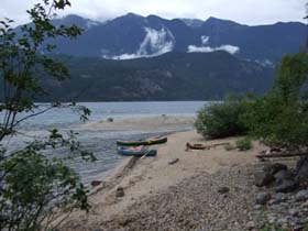
Nemo Creek Mouth
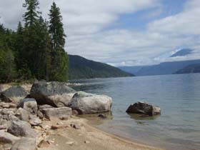
Sandy Beaches Between Rocks
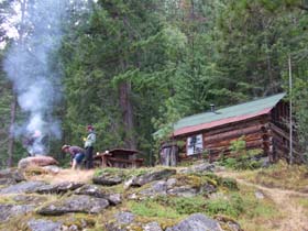
Old Trapper Cabin at Cove Creek
We take a longer break at Nemo Creek. The creek with its steep, wild waterfalls and quiet pools filled with turquoise water is of unmatched beauty. In the afternoon sun we continue to paddle until we reach Cove Creek. An old trapper cabin at a sheltered bay overlooks the lake.
We clean the cabin, build our camp for the night and lit the fireplace. Long into the night we enjoy being at this almost unreal place where we feel so far away from modern amenities.
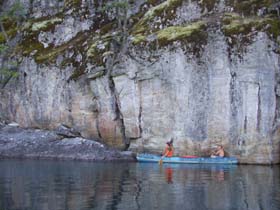
First Nation's Pictographs near Slocan
|
